JEO 15 - ArkEdge, VDES, and the Future of Maritime Safety
ArkEdge Space recently launched a new satellite that forms part of a test constellation for maritime situational awareness and VDES, the successor to AIS.
Welcome to Japan Earth Observer (JEO), a monthly newsletter about the space, Earth observation, and geospatial industries in Japan. ArkEdge Space recently launched a new satellite that forms part of a test constellation for maritime situational awareness. This anticipates the production rollout of a successor technology to the venerable and successful AIS communications system used for tracking and communication with ship. Read on to learn more.
ArkEdge and Japan are Moving Beyond AIS
ArkEdge Space (アークエッジ・スペース) successfully deployed a demonstration maritime communications satellite, AE1a, on the SpaceX Transporter 16 rideshare mission launched on 30 March (along with 118 other satellites! [Payload]). The new satellite is designed to operate as part of a three-satellite constellation to support demonstration of new technologies related to maritime communications and situational awareness. The other two satellites, AE1d and AEVa, were launched in January and June 2025, respectively. The satellites are testing features that include AIS signal collection, two-way communication, and antennas for the next generation of AIS, VHF Data Exchange System (VDES).
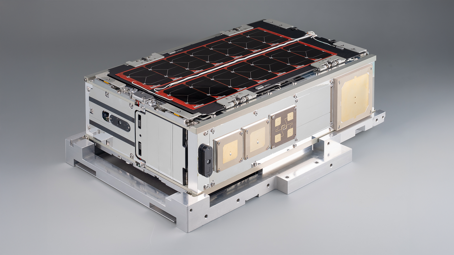
6U AE1a satellite prior to launch. Source: ArkEdge Space
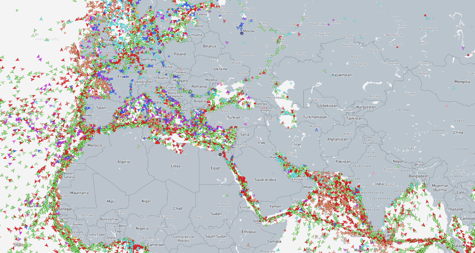
AIS is an incredibly important example of shared data infrastructure that enables the global shipping system to operate more safely. AIS is used by more than 300,000 vessels for ship-to-ship and ship-to-shore communications and all passenger ships as well as most large ships have an AIS transponder that reports position, heading, and status information. However, the current AIS technology was developed in the mid-1990s and first mandated in 2000, so it’s a few decades old. Shipping volumes have grown substantially since then. The current VHF channels used by AIS have limited bandwidth, and while it can support two-way text messaging, its use is limited to text-only safety-critical and operational messages. In highly congested areas, like ports, channels, and straits, the system's capacity is often exceeded, increasing risks of collision. The International Maritime Organization (IMO) would like to enhance safety by expanding its use to more ships, but the current system cannot support this. In addition, AIS spoofing by vessels engaged in illegal or sanctioned activities has become more common.
VDES is a major upgrade, offering wider coverage area with satellites, more bandwidth, and greater flexibility in terms of the types of data exchanged, including software updates, weather maps, ice maps, digital charts, and encrypted messaging through two sub-systems. VDE-TER is a sub-system for terrestrial ship-to-ship and ship-to-shore communications. VDE-SAT is a sub-system for satellite-to-ship transmissions. With bandwidth 32x greater than AIS, VDES will improve safety, help optimize maritime traffic (reducing emissions and fuel consumption), and will eventually enable uncrewed autonomous vessels to operate safely. The IMO will begin mandating VDES on all SOLAS-certified vessels (all passenger ships with more than 12 passengers and all cargo ships larger than 500 tons) by Jan 1, 2028 and then expanded to other ships in the following years.
What is SOLAS? SOLAS is the International Convention for the Safety of Life at Sea [IMO], the primary international treaty governing merchant ship safety. It was originally adopted in 1914 following the Titanic disaster and has been continuously updated since then. SOLAS implementation and updates has been managed by the International Maritime Organization since 1958.
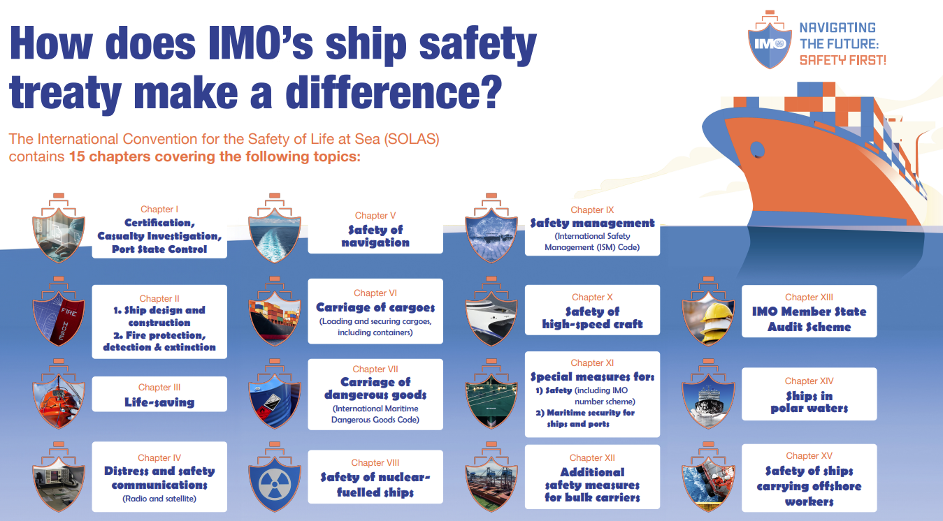
Chapters of the SOLAS treaty. Source: IMO
ArkEdge is testing the technologies that will enable it to provide global VDES coverage through a future constellation. Other companies are developing VDES satellite capabilities as well. Swedish firms AAC Clyde Space and Saab have been testing VDES transponders on the YMIR-1 satellite, and demonstrated two-way communications using VDES in 2024. Danish firm Sternula has launched and tested the first MARIOT satellite (Sternula-1) supporting VDES in 2023 and has plans for a full constellation. Portuguese LusoSpace is building the 12-satellite LUSIADA constellation based on the EPIC-8U satellite bus developed by AAC Clyde Space. The first batch of four LUSIADA satellites (Camões, Agustina, Pessoa, and Saramago) was just launched on the same SpaceX Transporter-16 rocket as the ArkEdge AE1a.
All four of the planned constellations are chasing a new VDES market that is expected to support at least three types of revenue:
- Data-as-a-Service - similar to the SpaceX Starlink and Amazon LEO services, the new constellations will be able to sell data communications subscriptions to shipping companies, port authorities, and logistics firms to support global, real-time, bi-directional data transmission.
- Safety-as-a-Service - national maritime agencies may opt to pay for sovereign coverages of their flagged ships in critical areas like the Arctic in order to support search-and-rescue and maritime safety operations.
- Satellite Infrastructure-as-a-Service - AAC Clyde Space is licensing its satellite bus technology to LusoSpace as well as leading development of the INFLECION satellites. As ICEYE and Planet Labs have found, the opportunity to manufacture and operate dedicated satellites on behalf of governments can be a significant market on its own.
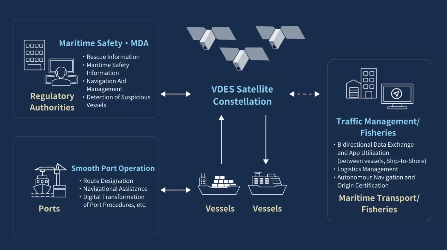
ArkEdge’s VDES maritime services concept. Source: ArkEdge Space
Developing a new capital-intensive technology can be a risky endeavor, and each of these four efforts should probably be characterized as public-private ventures. They have all benefited from industrial policy funding from their respective governments:
- AE1a and its sister satellites have enjoyed funding support from two programs at New Energy and Industrial Technology Development Organization (NEDO) (国立研究開発法人新エネルギー・産業技術総合開発機構) as well as some JAXA funding.
- LusoSpace has €15 Million of public funding from the Portugal Recovery and Resilience Plan (PRR) and is a major initiative of Project NewSpace Portugal, an effort to establish a domestic space industry ecosystem.
- The AAC Clyde Space, ORBCOMM, and Saab (AOS) consortium received funding from the Swedish Transport Administration (Trafikverket) to support development of the first YMIR-1 demonstration satellite. The full constellation, called INFLECION, will also be developed by a consortium, but one based in the UK, rather than Sweden. The INFLECION satellites will be much more capable, including not only VDES communications but also signals intelligence and SAR imaging capabilities aimed at combatting smuggling and illegal fishing. INFLECION is being funded with €30 million from the UK Space Agency and ESA.
- Sternula's MARIOT project received DKK 20 million (~€2.6 million) from Innovation Fund Denmark to build the initial infrastructure and the first satellite (Sternula-1) as well as additional Danish channeled through ESA. This public funding is specifically earmarked for VDES deployment covering the Arctic.
ArkEdge’s constellation is still in demonstration mode, and it remains to be seen how it will differentiate itself from the other three efforts, but the JAXA funding points toward the potential for integrating VDES capabilities with navigation and positioning functions. JAXA is funding an experiment to leverage higher precision positioning data via the new L6 signal on the QZSS (Michibiki) satellites to test detection of tides, tsunamis and other sea disturbances via a network of buoys [GPS World] as well as a feasibility study on development of a positioning constellation in low Earth orbit (LEO-PNT) [ArkEdge] that could augment the QZSS constellation. ArkEdge is also building out a constellation of imaging satellites that could potentially be integrated with additional services.
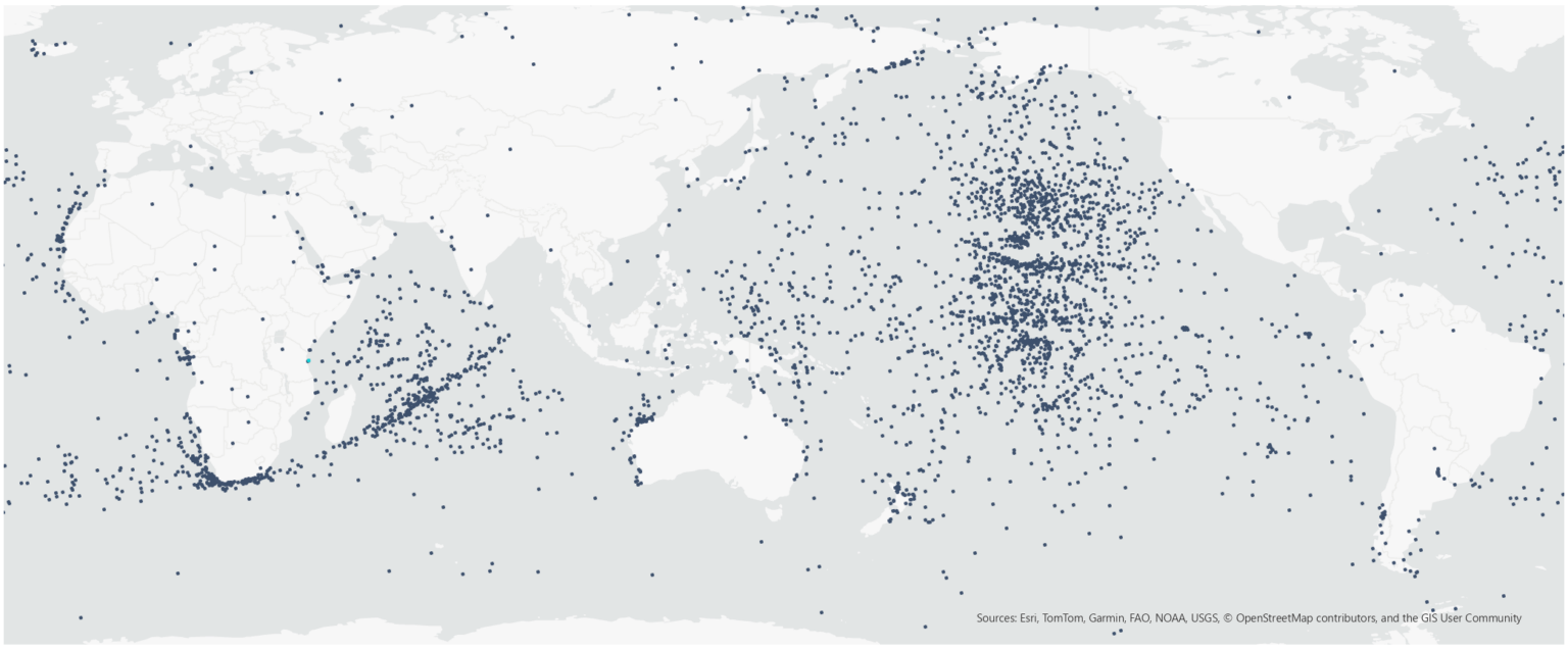
AIS signal reception data acquired by AE3Va. Source: ArkEdge Space
If you’ve made it this far, thank you for reading. Please be in touch via LinkedIn with any feedback, questions, comments, or requests for future topics. And if you have a friend or colleague that you think would enjoy JEO, please share it!
Until next time,
Robert
Spring rain:
walking and talking
together with two umbrellas.
– Yosa Buson (1716–1784) - translated by William Scott Wilson
春雨や
ものがたり行く
傘二つ
harusame ya
monogatari yuku
kasa futatsu